- Pictorial Library
- Galilée et Nord
- Samarie et Centre
- Jérusalem
- Juda et Mer Morte
- Néguev et Désert
- Jordanie
- Egypte
- Liban
- Turquie Orientale et Centrale
- Turquie Occidentale
- Grèce
- Les Iles Grecques
- Chypre et Crète
- Italie et Malte
- Rome
- Arbres, Plantes, et Fleurs
- Images Culturelles de la Terre Sainte
- Pancartes de la Terre Sainte
- Collection Complète
Pictorial Library

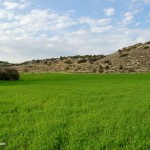
Juda et Mer Morte
Toutes les images sont des fichiers jpg de haute résolution (1600 x 1200 ou plus), idéales pour projection dans les classes, pour visionnage sur un moniteur ou pour être imprimées. Aussi, sont compris sur chaque DVD des fichiers PowerPoint déjà préparés sur chaque région (avec annotations pour les photos), des cartes d’identification de sites, un index d’images, et un index de sites.
En savoir plus sur les sites dans ce Volume
Index of Photographs on this DVD
- Bethlehem
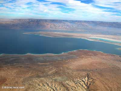
- Dead Sea
- En Gedi
- Hebron
- Herodium
- Joppa-Tel Aviv
- Judean Hill Country-Aqueducts
- Judean Hill Country-North
- Judean Hill Country-South
- Masada
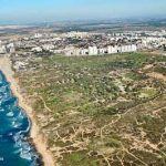
- Philistine Plain
- Philistine Plain-Ashkelon
- Qumran
- Qumran Caves
- Shephelah
- Shephelah-Aijalon Valley
- Shephelah-Elah Valley
- Shephelah-Gezer
- Shephelah-Guvrin Valley
- Shephelah-Lachish
- Shephelah-Sorek Valley
- Wilderness of Judah-North
- Wilderness of Judah-South
- Wilderness of Judah-Wadi Qilt
Bethlehem (44)
Bethlehem aerial from north, df010703221
Bethlehem aerial from north, df010703222
Bethlehem and Herodium view east from Beit Jalla, tbs43099009
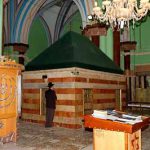
Bethlehem Church of Milk Grotto altar, tb102603488
Bethlehem Church of Milk Grotto, tb102603484
Bethlehem Church of Nativity courtyard, tb102603522
Bethlehem Church of Nativity doorway, tb102603511
Bethlehem Church of Nativity entrance, tb102603434
Bethlehem Church of Nativity entrance, tb102603442
Bethlehem Church of Nativity entrance, tbs44059009
Bethlehem Church of Nativity interior, tb102603436
Bethlehem Church of Nativity interior, tb102603445
Bethlehem Church of Nativity mosaic floors, tb102603443
Bethlehem Church of Nativity mosaic floors, tb102603444
Bethlehem Church of Nativity, cave of birth, tb102603458
Bethlehem Church of Nativity, cave of birth, tb102603461
Bethlehem Church of Nativity, Franciscan chapel, tb102603497
Bethlehem Church of Nativity, Jerome statue, tb102603506
Bethlehem Church of Nativity, traditional place of Jesus’ birth, tbs43339009
Bethlehem Church of Nativity, traditional place of Jesus’ birth, tbs43349009
Bethlehem Church of Nativity, traditional place of manger, tbs43329009
Bethlehem from above, tbs43109009
Bethlehem from Herodium, tb010210581
Bethlehem from north panorama, tb030103223
Bethlehem from north, tb030103225
Bethlehem from north, tb092405372
Bethlehem from north, tb111106895
Bethlehem Lutheran Christmas Church, tb010107295
Bethlehem marketplace and street, tbs44019009
Bethlehem olive wood factory, cd090321007
Bethlehem olive wood factory, cd090321018
Bethlehem olive wood factory, cd090321023
Bethlehem Peace Center, tb102603429
Bethlehem Rachel’s Tomb entrance, tb092204903
Bethlehem Rachel’s Tomb, tb092204904
Bethlehem view of city, tb102603515
Hill country east of Bethlehem, tb102603552
Olive grove near Bethlehem, tb092405378
Shepherd with flock near Bethlehem, tbs43309009
Shepherd with sheep east of Bethlehem, tb052105021
Shepherds’ Fields near Bethlehem, tbs43289009
Terraced hillside near Bethlehem, tb010107217
Terraced hillside near Bethlehem, tb010107218
Women harvesting wheat near Bethlehem, cd060087010
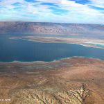
Dead Sea (100)
Date palm trees near Dead Sea, tb011703230
Dead Sea aerial from north, tb121704193
Dead Sea aerial from northwest, tb010703731
Dead Sea aerial from west, tb010703232
Dead Sea and mountains of Moab from Qumran, tbs51299011
Dead Sea and mountains of Moab from west, tb092706272
Dead Sea and mountains of Moab from west, tb092706293
Dead Sea and mountains of Moab from west, tb092706295
Dead Sea beach at Ein Bokek, tb030106420
Dead Sea beach with Jordan mountains, tb021503233
Dead Sea beach with lifeguard stand, tb010810107
Dead Sea beach, tb010810063
Dead Sea cliffs north of En Gedi aerial, tb010703661
Dead Sea from En Gedi, tb021603238
Dead Sea from Masada, tb010810995
Dead Sea from west panorama, tb092706276
Dead Sea from west, tb092706266
Dead Sea from west, tb092706278
Dead Sea hot spring on shore, tb022806407
Dead Sea Lisan aerial from west, tb010703739
Dead Sea Lisan aerial from west, tb121704254
Dead Sea lowest point on earth, 416 meters below sea level, tb030206538
Dead Sea lowest point on earth, 416 meters below sea level, tb030206539
Dead Sea lowest point on earth, 416 meters below sea level, tb030206557
Dead Sea lowest point on earth, 416 meters below sea level, tb030206569
Dead Sea mud along shore, tb010810073
Dead Sea mud on shore, tb010810081
Dead Sea mud terraced shoreline, tb011703241
Dead Sea mud with salt, tb030206554
Dead Sea northern end aerial from west, tb010703242
Dead Sea northern end and Qumran aerial from west, tb010703243
Dead Sea PEF Marker of water level in 1904, tb011703244
Dead Sea PEF Marker of water level in 1904, tb021107651
Dead Sea pier out of water, tb021905579
Dead Sea pier out of water, tb021905580
Dead Sea salt crystals on log, tb030206542
Dead Sea salt crystals, tb030206535
Dead Sea shoreline aerial, tb010703246
Dead Sea shoreline from northwest with Mizpe Shalem, tb021107641
Dead Sea shoreline from south, tb021107639
Dead Sea shoreline north of Ein Bokek, tb030206502
Dead Sea shoreline with hills near Mizpe Shalem, tb021107643
Dead Sea shoreline with hills near Mizpe Shalem, tb021107644
Dead Sea shoreline with salt crystals, df022702221
Dead Sea shoreline with salt crystals, tb011703245
Dead Sea shoreline with salt crystals, tb022806367
Dead Sea shoreline with salt crystals, tb022806385
Dead Sea shoreline with salt crystals, tb022806387
Dead Sea shoreline with salt crystals, tb022806390
Dead Sea shoreline with salt crystals, tb030206526
Dead Sea shoreline with salt crystals, tb030206531
Dead Sea shoreline with salt crystals, tb030206536
Dead Sea shoreline with salt formations, tb030206567
Dead Sea shoreline with salt, tb030206559
Dead Sea shoreline, tb100200217
Dead Sea southern end from west, tb052307928
Dead Sea view of lake from above PEF Marker, tb011703401
Dead Sea water level in 1984 at Ein Feshka, tb021107657
Dead Sea water level in 1984 at Ein Feshka, tb021107659
Dead Sea western cliffs to south from En Gedi, tbs108260010
Dead Sea with Ein Bokek hotels from above panorama, tb030206501
Dead Sea with Ein Bokek hotels from above, tb030106474
Dead Sea with Ein Bokek hotels from above, tbs95189711
Ein Bokek Roman fort from above, tb030106483
Ein Bokek Roman fort interior, tb030106492
Ein Feshka and Dead Sea from northwest, tb092706274
Ein Feshka industrial area mikveh, tb021107673
Ein Feshka industrial complex, tb021107668
Ein Feshka rural villa, tb021107671
Ein Feshka with view north to Qumran, tb021107661
Ein Feshka, tb021107653
Ein Feshka, tb021107656
En Gedi Dead Sea swimming area, tbs108250010
Jordan River entering Dead Sea aerial from west, tb010703283
Lisan marl near Masada aerial, bb00080037
Lisan marl near Masada aerial, bb00080038
Lisan marl near Masada aerial, tb010703298
Lisan marl near Masada, tb030206511
Lisan marl near Masada, tb030206513
Lisan marl near Masada, tb030206515
Lot’s wife, tb022804741
Man covered in Dead Sea mud, tb052503240
Man digging Dead Sea mud, tb052503236
Man floating in Dead Sea with newspaper, tb100403503
Man floating in Dead Sea, tb030907212
Man floating in Dead Sea, tb052503237
Mount Sodom aerial, bb00080046
Mount Sodom from north, tb052307915
Mountains along Dead Sea shoreline, tb031504915
Nahal Arnon aerial from west, tb121704204
Plains of Moab from southwest, tb092706271
Rainbow over Dead Sea, tb021503356
Sun rays over Dead Sea from west, tb010505499
Sunrise over Dead Sea from En Gedi, tb021906177
Sunrise over Dead Sea from En Gedi, tb021906191
Sunrise over Dead Sea from En Gedi, tb021906194
Sunrise over Dead Sea from En Gedi, tb100304834
Sunrise over Dead Sea from En Gedi, tb100304836
Sunrise over Dead Sea from En Gedi, tb100503511
Sunset over Judean wilderness cliffs, tbs52249011
En Gedi (82)
Acacia tree at En Gedi, tb021603201
Ascent of Ziz above En Gedi with Nahal David, tb021603210
Ascent of Ziz above En Gedi with Nahal David, tb022005642
En Gedi aerial from south, tb010703262
En Gedi and Dead Sea, tb011100226
En Gedi and Dead Sea, tb011100233
En Gedi and Nahal Arugot aerial from east, tb010703270
En Gedi and Nahal Arugot aerial from northwest, tb010703271
En Gedi and Nahal Arugot view south from above, tbs108230010
En Gedi and Nahal David aerial from northwest, tb010703272
En Gedi area aerial from east, tb010703279
En Gedi area aerial from south, tb010703263
En Gedi area aerial from south, tb010703264
En Gedi cave in Nahal David, tb010812258
En Gedi Chalcolithic temple from above, tb100304892
En Gedi Chalcolithic temple from west, tb100106530
En Gedi Chalcolithic temple from west, tb100106532
En Gedi Chalcolithic temple gatehouse, tb100503573
En Gedi Chalcolithic temple long room, tb021603268
En Gedi Chalcolithic temple long room, tb100503570
En Gedi from above with Chalcolithic temple, tb021603269
En Gedi from above, tb111603175
En Gedi mountains with palm groves from southwest, tb021603273
En Gedi mountains with palm groves, tb010810121
En Gedi mountains with palm trees, tb010810112
En Gedi Nahal Arugot bridge washed out from east, tb052301288
En Gedi Nahal Arugot bridge washed out from north, tb052301289
En Gedi Nahal Arugot bridge washed out from west, tb052301290
En Gedi Nahal Arugot from northeast, tb021603330
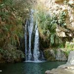
En Gedi Nahal Arugot Hidden Waterfall, tb021906282
En Gedi Nahal Arugot Hidden Waterfall, tb021906285
En Gedi Nahal Arugot spring emerging from rock, tb100304871
En Gedi Nahal Arugot stream, tb100304873
En Gedi Nahal Arugot to west, tbs108220010
En Gedi Nahal Arugot with Dead Sea from above, tbs108210010
En Gedi Nahal Arugot with flowing water, tb021906276
En Gedi Nahal David after fire, tb102205405
En Gedi Nahal David after fire, tb102205409
En Gedi Nahal David and Dead Sea from west, tb052307909
En Gedi Nahal David and Dead Sea from west, tb100106497
En Gedi Nahal David and Dead Sea, tb011100228
En Gedi Nahal David and Dead Sea, tb052307913
En Gedi Nahal David caves, tb022005690
En Gedi Nahal David caves, tb052705253
En Gedi Nahal David Dry Canyon, tb021906303
En Gedi Nahal David Dry Canyon, tb100106447
En Gedi Nahal David Dry Canyon, tb100106521
En Gedi Nahal David Dudim Cave, tb022005664
En Gedi Nahal David flowing water, tb100106539
En Gedi Nahal David water pool, tb100503620
En Gedi Nahal David waterfall, tb010812263
En Gedi Nahal David waterfall, tb010812273
En Gedi Nahal David waterfall, tb030401236
En Gedi Nahal David waterfall, tb040900229
En Gedi Nahal David waterfall, tb052705261
En Gedi Nahal David waterfalls, tb052307908
En Gedi spring area from below, tb100304868
En Gedi spring, tb021603275
En Gedi spring, tb100503558
En Gedi synagogue and excavations from above, tb021603276
En Gedi synagogue mikveh, tb100503520
En Gedi synagogue mosaic floor, tb100503519
En Gedi Tel Goren from above, tb021603277
En Gedi Tel Goren view east, tb021603278
En Gedi trees with Dead Sea, tb102205414
Hyrax, rock badger, coney at En Gedi, tb030401248
Hyrax, rock badger, coney with Dead Sea at En Gedi, tb021603359
Ibex at En Gedi, tb021906234
Ibex at En Gedi, tb040900253
Ibex at En Gedi, tb102205333
Ibex at En Gedi, tb102205374
Ibex at En Gedi, tb102205392
Ibex at En Gedi, tb102205413
Ibex at En Gedi, tb102205417
Ibex at En Gedi, tbs72219211
Ibex climbing down hill at En Gedi, tb021906247
Ibex drinking from Nahal David at En Gedi, tb100503600
Ibex kids at En Gedi, tb040900255
Ibex male herd at En Gedi, tb021906258
Ibex on hill at En Gedi, tb021906214
Ibex with kids at En Gedi, tb040900256
Nahal David from above, tbs108270010
Hebron (46)
Hebron Abraham Avinu synagogue, tb092204094
Hebron Abu Sneineh hill from Machpelah, tb092204004
Hebron from north with snow, tb122906179
Hebron Israeli post separating Palestinian Authority and Jewish areas, tb092204940
Hebron Machpelah aerial from east, bb00010101
Hebron Machpelah aerial from southeast, bb00010105
Hebron Machpelah from southeast, tb111706136
Hebron Machpelah older men meeting, tb092204008
Hebron Machpelah pilasters on southern wall, tb092204000
Hebron Machpelah pilasters, tb112799204
Hebron Machpelah protruding stones in eastern wall, tb092204993
Hebron Machpelah southeastern corner, tb111706134
Hebron Machpelah, Abraham’s cenotaph, tb021900338
Hebron Machpelah, Abraham’s cenotaph, tb092204066
Hebron Machpelah, Isaac hall ceiling, tb092204019
Hebron Machpelah, Isaac’s cenotaph and 11th century pulpit, tb021900213
Hebron Machpelah, Isaac’s cenotaph, tb092204027
Hebron Machpelah, Jacob’s cenotaph, tb092204050
Hebron Machpelah, Rebecca’s cenotaph, tb092204026
Hebron Machpelah, Sarah’s cenotaph, tb021900339
Hebron Machpelah, shaft to caves below, tb021900209
Hebron Machpelah, shaft to caves below, tb092204022
Hebron Machpelah, tb092204978
Hebron Machpelah, tb092204983
Hebron Machpelah, tb112799205
Hebron modern city from south, tb092204954
Hebron, Tell Rumeida, Israelite four-room house under Beit Menachem, tb092204944
Hebron, Tell Rumeida, Israelite four-room house under Beit Menachem, tb092204950
Mamre Byzantine church in enclosure, tb122906154
Mamre eastern wall with pilasters, tb122906166
Mamre enclosure from northwest corner, tb122906132
Mamre enclosure from southeast corner, tb122906157
Mamre enclosure from southeast, tb122906150
Mamre north wall with gate and pilasters, tb122906127
Mamre north wall with pilasters, tb122906119
Mamre north wall with pilasters, tb122906124
Mamre southeast corner stone with drafted margins, tb122906115
Mamre southern wall from east, tb122906176
Mamre southern wall with two faces, tb122906151
Mamre southern wall, tb122906177
Mamre southwest corner with well of Abraham, tb122906141
Terraced hillside near Hebron, tb111706182
Vineyards and terraced hillside near Hebron, tb111706185
Vineyards in fall colors near Hebron, tb111706130
Vineyards in fall colors near Hebron, tb111706174
Vineyards north of Hebron, tb092204926
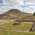
Herodium (54)
Arab village and mosque near Herodium, tb123111086
Herodium aerial from northeast, bb00100068
Herodium aerial from northwest, bb00100076
Herodium aerial from northwest, bb00100079
Herodium aerial, bb00100086
Herodium and Judean wilderness from southwest, tb111706018
Herodium and Nahal Tekoa from south, tb111706113
Herodium Bar Kochba tunnels in cisterns, tb092105296
Herodium bathhouse caldarium, tb123111071
Herodium bathhouse caldarium, tepidarium, apodyterium, tb010100246
Herodium bathhouse tepidarium, tb123111073
Herodium catapult balls, tb092105301
Herodium cistern, tb051504636
Herodium cistern, tb052106492
Herodium concentric ring walls and northern tower, tb092105277
Herodium concentric ring walls, tb092105265
Herodium courtyard and bathhouse, tb102603572
Herodium decorated stone, tb123111075
Herodium exedra and courtyard colonnade, tb052106477
Herodium from north, tb092105326
Herodium from northeast with staircase, tb021107501
Herodium from northeast, tb021107502
Herodium from southwest, tb111706016
Herodium from southwest, tb111706059
Herodium Herod’s tomb area, tb051807679
Herodium Herod’s tomb excavations, tb051807683
Herodium Herod’s tomb excavations, tb051807688
Herodium Herod’s tomb excavations, tb051807695
Herodium Herod’s tomb fragment, tb051807689
Herodium Herod’s tomb from above, tb051807667
Herodium Herod’s tomb, tb051708036
Herodium interior from north panorama, tb09210525p
Herodium interior from north, tb092105260
Herodium lower city from above, tb021407730
Herodium lower city from above, tb052106473
Herodium mikveh, tb051504630
Herodium mikveh, tb123111079
Herodium mikveh, tb123111081
Herodium northern tower compartments, tb092105258
Herodium solid tower and courtyard, tb052106474
Herodium stone fragment in cistern, tb052106481
Herodium synagogue, tb102603576
Herodium synagogue, tb123111078
Herodium synagogue, tb123111088
Herodium theater, tb010210567
Herodium view northwest to Bethlehem, tb051807672
Herodium with lower pool, tb021407734
Herodium with lower pool, tb021407739
Herodium with lower pool, tb102603555
Judean wilderness and Jerusalem from Herodium, tb010210577
Judean wilderness and Transjordan mountains from Herodium panorama, tb010210569
Judean wilderness and Transjordan mountains from Herodium, tb010210570
Judean wilderness and Transjordan mountains from Herodium, tb010210573
Judean wilderness in spring from Herodium, tb021407731
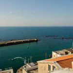
Joppa-Tel Aviv (55)
Jaffa and Tel Aviv aerial from southwest, tb121704866
Joppa aerial from southwest, tb121704872
Joppa aerial from southwest, tbs130100112
Joppa aerial from west, tb121704877
Joppa aerial from west, tb121704879
Joppa aerial from west, tb121704881
Joppa aerial from west, tbs130070112
Joppa ancient ruins in visitor’s center, tb101806982
Joppa ancient ruins in visitor’s center, tb101806983
Joppa ancient ruins in visitor’s center, tb101806984
Joppa and Tel Aviv aerial from south, tb121704869
Joppa and Tel Aviv aerial from southwest, tb121704874
Joppa Andromeda’s Rock from southeast, tb101806035
Joppa clock tower, tb101806009
Joppa Egyptian Late Bronze fortress, 13th c BC, tb101806977
Joppa Egyptian Late Bronze fortress, 13th c BC, tb101806979
Joppa entrance with clock tower, tb101806018
Joppa fortifications and police station, tb101806016
Joppa fountain of Abu Nabut, tb101806022
Joppa harbor and Andromeda’s Rock from east, tb101806033
Joppa harbor, kg031401252
Joppa House of Simon the Tanner with owner, tb101806038
Joppa House of Simon the Tanner, tb101806965
Joppa House of Simon the Tanner, tb101806966
Joppa ocean view with minaret, tb101806997
Joppa pilgrim hostel, tb101806042
Joppa sculpture of Jonah’s fish, tb101806044
Joppa St Peter’s Church and shoreline, mm100412001
Joppa St Peter’s Church from southeast, mm100413004
Joppa St Peter’s Church, kg031401253
Joppa St Peter’s Church, tb101806980
Tel Aviv aerial from southwest, tb121704860
Tel Aviv aerial from southwest, tbs130150112
Tel Aviv aerial from west, tb121704868
Tel Aviv aerial from west, tb121704891
Tel Aviv aerial from west, tbs130000112
Tel Aviv and Yarkon River aerial from west, tb121704895
Tel Aviv beach aerial, cd050095114
Tel Aviv shoreline view north from Joppa, tb101806028
Tel Aviv shoreline view north from Joppa, tb101806999
Tel Aviv skyscrapers aerial from southwest, tb121704864
Tel Aviv with Napoleon’s cannons, tb101806001
Tell Qasile four-room house, tb061804524
Tell Qasile four-room house, tb061804526
Tell Qasile from southeast, tb061804506
Tell Qasile Philistine temple excavations, tb061804508
Tell Qasile Philistine temple excavations, tb061804509
Tell Qasile Philistine temple excavations, tb061804511
Tell Qasile Philistine temple excavations, tb061804512
Tell Qasile Philistine temple excavations, tb061804515
Tell Qasile public building, tb061804522
Tell Qasile reconstructed four-room house, tb061804517
Tell Qasile reconstructed four-room house, tb061804529
Tell Qasile Roman period pottery kiln, tb061804527
Yarkon River, tb082304356
Judean Hill Country-Aqueducts (43)
Arrub aqueduct south of Solomon’s Pools, tb112406393
Arrub aqueduct south of Solomon’s Pools, tb112406394
Arrub aqueduct south of Solomon’s Pools, tb112406396
Arrub aqueduct south of Solomon’s Pools, tb112406413
Arrub aqueduct south of Solomon’s Pools, tb112406414
Arrub aqueduct to Solomon’s Pools, tb112406431
Biyar aqueduct possible tunnel shaft, tb112406249
Biyar aqueduct south of Solomon’s pools, tb112406383
Biyar aqueduct south of Solomon’s pools, tb112406457
Biyar aqueduct south of tunnel, tb112406301
Biyar aqueduct south of tunnel, tb112406312
Biyar aqueduct tunnel shaft, tb112406267
Biyar aqueduct tunnel, tb112406269
Jerusalem low-level aqueduct beneath Haas Promenade entrance, tb091306402
Jerusalem low-level aqueduct beneath Haas Promenade, tb042206496
Jerusalem low-level aqueduct beneath Haas Promenade, tb091306387
Jerusalem low-level aqueduct beneath Haas Promenade, tb091306391
Jerusalem low-level aqueduct beneath Haas Promenade, tb091306395
Jerusalem low-level aqueduct beneath Haas Promenade, tb091306401
Jerusalem low-level aqueduct near Haas Promenade, tb042206499
Jerusalem low-level aqueduct near Haas Promenade, tb042206501
Roman high-level aqueduct in Bethlehem, tb112406475
Roman high-level aqueduct in Bethlehem, tb112406477
Roman high-level aqueduct in Bethlehem, tb112406480
Roman high-level aqueduct in Bethlehem, tb112406482
Roman high-level aqueduct in Bethlehem, tb112406489
Roman high-level aqueduct in Bethlehem, tb112406494
Solomon’s Pools aerial from east, bb00100103
Solomon’s Pools aerial from south, bb00100104
Solomon’s Pools aerial from west, bb00100112
Solomon’s Pools from east, tb112406422
Solomon’s Pools, eastern pool from east, tb112406429
Solomon’s Pools, eastern pool from west, tb021407751
Solomon’s Pools, eastern pool from west, tb112406433
Solomon’s Pools, eastern pool with pump house, tb021407754
Solomon’s Pools, eastern pool, tbs43119009
Solomon’s Pools, middle pool with boys swimming, tbs43139009
Solomon’s Pools, middle pool, tb021407745
Solomon’s Pools, middle pool, tb021407749
Solomon’s Pools, middle pool, tb112406438
Solomon’s Pools, western pool, tb112406443
Solomon’s Pools, western pool, tb112406445
Well connected to Biyar aqueduct, tb112406344
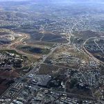
Judean Hill Country-North (108)
Almond tree in snow at Tantur, tb012900201
Bab el-Wad aerial from southeast, tbs135140112
Bab el-Wad aerial from southwest, tbs135110112
Bab el-Wad aerial from west, df010703213
Bab el-Wad complex, tb090906039
Beit Jalla with snow from northeast, tb030103214
Bether and Husan ridge from north, tb082406484
Bether and Husan ridge from north, tb082406490
Bether Arab village old buildings, tb082406494
Bether excavations with Jerusalem tumuli 2 and 4, tb010107247
Bether excavations, tb010107238
Bether excavations, tb010107239
Bether large wall excavations, tb010107241
Bether stone cutting, tb010107259
Bethlehem bypass road with tunnel from Beit Jalla view north, tb112406472
Cave of John the Baptist area, tb020305223
Cave of John the Baptist entrance, tb020305213
Cave of John the Baptist excavations, tb112602240
Cave of John the Baptist interior, tb020305209
Cave of John the Baptist interior, tb020305211
Chesalon from east, tb011007414
Chesalon with rock wall, tb011007413
Chesalon, tb011007404
Dinosaur track at Beit Zeit, tb042200718
Dinosaur tracks at Beit Zeit, tb042200719
Ein Haniye, spring of Philip, in Rephaim Valley, tb010107207
Ein Kerem area, tb031004821
Ein Kerem Church of St John from south, tb031004094
Ein Kerem Church of St John painting by El Greco, tb031004858
Ein Kerem Church of St John, tb031004799
Ein Kerem Church of Visitation cave of John, tb031004861
Ein Kerem Church of Visitation interior, tb031004844
Ein Kerem Church of Visitation, tb031004833
Ein Kerem from south, tb031004093
Ein Kerem from south, tb031004834
Ein Kerem terraces, tb031004830
Ein Kerem Well of Mary, tb031004826
Ein Kobi in Judean hills near Husan Ridge, tb121302222
Ein Limon in Nahal Chesalon, tb011007372
Ein Naquba Arab village from southeast, tb020305236
Ein Sataf spring house in Nahal Sorek, tb121302223
Ein Seadim in Nahal Sorek, tb070907040
Even Sapir and Monastery of St John in Wilderness from north, tb020305201
Hill with terracing and olive trees near Bether, tb010107264
Hill with terracing and olive trees near Bether, tb010107265
Hill with terracing and olive trees near Bether, tb010107266
Hill with terracing and olive trees near Bether, tb010107268
Husan from north, tb082406495
Husan ridge Roman road cutting in bedrock, tb050504545
Jerusalem and Ein Kerem from northwest, tb020305202
Jerusalem highway near Bab el-Wad, view east, tb090906043
Judean hills near Bether, tb010107232
Mar Elias area with snow, tb012900202
Mar Elias church interior, tb111206915
Mar Elias from north, tb111106845
Monastery of St John in Wilderness cave, tb020305175
Monastery of St John in Wilderness entrance, tb020305171
Monastery of St John in Wilderness from north, tb020305197
Monastery of St John in Wilderness, tb020305195
Moza, possible Emmaus, from north, tb090906025
Moza, possible Emmaus, from southwest, tb030803325
Moza, possible Emmaus, Herodian stones, tb030803326
Moza, possible Emmaus, old ruins, tb030803327
Moza, possible Emmaus, Old Synagogue, tb030803328
Moza, possible Emmaus, spring, tb030803329
Nahal Chesalon from Chesalon, tb011007418
Nahal Chesalon road, tb011007387
Nahal Chesalon road, tb011007393
Nahal Chesalon with cliffs, tb011007395
Nahal Chesalon, tb011007394
Nahal Chesalon, tb011007400
Nahal Sorek with stream, kg031901292
Nahal Sorek, tb060906203
Ramat Rahel ancient site from south, tb092405356
Ramat Rahel ancient site from south, tb111106884
Ramat Rahel Byzantine dining hall, tb113002562
Ramat Rahel excavations with Proto-Aeolic capitals, tb031905801
Ramat Rahel excavations, tb031905809
Ramat Rahel Iron Age wall, tb111100321
Ramat Rahel Israelite wall with ashlar masonry, tb113002566
Ramat Rahel Israelite wall with ashlar masonry, tb113002567
Ramat Rahel mikveh, tb113002561
Ramat Rahel stone manger with child, tb111100322
Ramat Rahel stone manger, tb111100323
Reconstructed remains near Sataf, tb121302264
Rephaim Valley aerial from north, df010703357
Rephaim Valley from northwest, tb121302265
Rephaim Valley from west, tb070807025
Rephaim Valley near Ein Haniye, spring of Philip, tb010107210
Reservoir near Moza, possible Emmaus, from southeast, tb030803358
Roman road to Moza, possible Emmaus, tb030803361
Roman road to Moza, possible Emmaus, tb030803362
Stalactite Cave above Nahal Sorek, tb101602266
Stalactite Cave above Nahal Sorek, tb101602267
Stalactite Cave above Nahal Sorek, tb101602268
Stalactite Cave above Nahal Sorek, tb101602269
Suleiman’s fortress at Solomon’s Pools, tb010210564
Suleiman’s fortress at Solomon’s Pools, tb092105351
Terraced hillside south of Abu Gosh, tb121302272
Terraced wall fallen down near Abu Gosh, tb121302273
Zobah castle and village ruins, tb020305207
Zobah from south, tb020305224
Zobah remains, tb020305243
Zobah ruins and almond tree, tb020305227
Zobah ruins, tb020305229
Zobah ruins, tb020305232
Zobah ruins, tb020305233
Zobah spring, tb020305226
Judean Hill Country-South (69)
Ancient tomb near Beit Umar, tb122906206
Artas convent, tb112406506
Artas from south, tb112406407
Beth-Zur tell summit with snow, tb122906189
Beth-Zur tell with view to Burj es-Sur, tb122906193
Beth-Zur with snow from west, tb122906197
Debir, Khirbet Rabud, cave entrance, tb022407385
Debir, Khirbet Rabud, from south, tb030407783
Debir, Khirbet Rabud, lower springs, tb022407398
Debir, Khirbet Rabud, lower springs, tb022407408
Debir, Khirbet Rabud, ruins on summit, tb022407378
Debir, Khirbet Rabud, well, tb022407388
Debir, Khirbet Rabud, well, tb022407392
Etam and Artas from southwest, tb112406241
Etam and Artas from west, tb112406242
Judean hills and vineyards with snow, tb122906094
Judean hills and vineyards with snow, tb122906105
Judean hills and vineyards with snow, tb122906106
Judean hills and vineyards with snow, tb122906108
Judean hills and vineyards with snow, tb122906112
Judean hills and vineyards, tb030407761
Judean hills and vineyards, tb112406462
Judean hills near Debir, Khirbet Rabud, tb030407777
Judean hills with olive trees near Debir, Khirbet Rabud, tb030407774
Judean hills with snow view north from Beth-Zur, tb122906185
Judean hills with snow view northwest from Beth-Zur, tb122906186
Judean hills with terraced wadi near Debir, Khirbet Rabud, tb030407788
Judean wilderness view east from Ziph panorama, tb111706663
Judean wilderness view east from Ziph, tb111706164
Khirbet et-Tayibeh ruins and illegal excavations, tb030407760
Khirbet et-Tayibeh view to west, tb030407750
Maon from south, tb032107439
Path through vineyards in Wadi Biyar, tb112406328
Path through vineyards with donkey in Wadi Biyar, tb112406330
Private garden and vineyards in Wadi Biyar, tb112406336
Sheep and pool in Carmel, tbs103029903
Sheep grazing at Tekoa, tb111706002
Sheep near Debir, Khirbet Rabud, lower springs, tb022407400
Shephelah and western Judean hills view north from Khirbet et-Tayibeh, tb030407756
Stone manger at Tekoa, tb111706040
Tekoa carved stone, tb111706029
Tekoa caves, tb111706024
Tekoa corner of large building, tb111706979
Tekoa corner of large building, tb111706982
Tekoa from south, tb111706043
Tekoa olive orchard, tb111706038
Tekoa ruins with Herodium and Judean Wilderness, tb111706014
Tekoa ruins with stone wall, tb111706994
Tekoa ruins with view north, tb111706988
Tekoa ruins, tb111706028
Tekoa ruins, tb111706972
Tekoa stone moat, tb111706033
Tekoa stone moat, tb111706036
Tekoa tomb entrance, tb111706027
Tekoa tombs in vineyard, tb111706026
Tekoa wall of semi-ashlar stones, tb111706037
Tekoa well with stone cover, tb111706030
Telem settlement view northwest from Khirbet et-Tayibeh, tb030407751
Vineyard in Wadi Biyar, tb112406363
Vineyard in Wadi Biyar, tb112406374
Vineyard in Wadi Biyar, tb112406379
Vineyards in Wadi Biyar, tb112406317
Vineyards in Wadi Biyar, tb112406325
Vineyards in Wadi Biyar, tb112406326
Vineyards in Wadi Biyar, tb112406334
Watchtower in Judean hills, tb010107224
Western Judean hills view north from Khirbet et-Tayibeh, tb030407753
Ziph from west, tb111706169
Ziph view south to Carmel and Maon, tb021900341
Masada (128)
Judean wilderness and Masada aerial from west, tb010703380
Masada aerial from east, tb010703303
Masada aerial from east, tb010703304
Masada aerial from east, tb010703317
Masada aerial from north, tb010703305
Masada aerial from northwest, tb010703306
Masada aerial from south, tb010703308
Masada aerial from south, tb010703309
Masada aerial from south, tb010703310
Masada aerial from south, tb121704216
Masada aerial from south, tb121704262
Masada aerial from southeast, tb010703307
Masada aerial from southwest, tb010703311
Masada aerial from southwest, tb121704219
Masada aerial from west, tb010703312
Masada and Dead Sea aerial from northwest, tb010703313
Masada and Dead Sea aerial from west, tb010703314
Masada and Dead Sea Lisan aerial from west, tb010703315
Masada and Dead Sea shore aerial from s, tb010703316
Masada and Dead Sea southern end aerial, tb010703247
Masada aqueduct to western cisterns, tb052307849
Masada bathhouse apodyterium frescoes, tb010812194
Masada bathhouse apodyterium frescoes, tb011100271
Masada bathhouse caldarium floor supports, tb011100273
Masada bathhouse caldarium reconstruction, tb011100274
Masada bathhouse caldarium, tb010812198
Masada bathhouse frigidarium, tb010810983
Masada bathhouse frigidarium, tb010812197
Masada bathhouse from northeast, tb010810998
Masada bathhouse tepidarium frescoes, tb052104814
Masada bet midrash, tb011100276
Masada buildings south of Roman tower, tb111002245
Masada Byzantine church, tb010810020
Masada Byzantine church, tb011100277
Masada Casemate of the Scrolls, tb052606546
Masada Casemate of the Scrolls, tb052606547
Masada casemate room of Ben Sira scroll, tb010810053
Masada casemate wall on southwest side, tb010812202
Masada casemate wall on southwest side, tb010812203
Masada catapult balls, tb022904747
Masada catapult reconstruction, kg101900278
Masada cistern on northern end, tb010810005
Masada columbarium, tb010810018
Masada commandant’s residence, tb022904750
Masada from east, tb111002249
Masada from east, tbs51159011
Masada from west, tbs50339011
Masada large southern cistern plaster, tb010812241
Masada large southern cistern steps, tb010812226
Masada large southern cistern steps, tb010812228
Masada large southern cistern, mf111002251
Masada large southern cistern, tb010812235
Masada large southern cistern, tb010812244
Masada large southern cistern, tb010812248
Masada mikveh, mf111002252
Masada mikveh, tb010810979
Masada northern end aerial from west, tb010703318
Masada northern end aerial from west, tb121704234
Masada northern palace aerial from northeast, tb121704226
Masada northern palace aerial from west, tb121704223
Masada northern palace aerial from north, tb121704246
Masada northern palace from above, tb052606549
Masada northern palace from southwest, tb010810008
Masada northern palace lowest level Corinthian capital, tb111002253
Masada northern palace lowest level frescoes, tbs51089011
Masada northern palace lowest level, tb111002254
Masada northern palace model, tb010810991
Masada northern palace, Herod’s bedroom, tb010810996
Masada northern palace, tbs50369011
Masada plastered walls and benches, tb010810002
Masada Roman main siege camp from east, tb052104817
Masada Roman main siege camp, tb052307857
Masada Roman siege camp aerial, tb121704217
Masada Roman siege camp reconstructed, tb010810961
Masada Roman siege camp reconstructed, tb052705243
Masada Roman siege camp, tb010810969
Masada Roman siege camps on east side aerial from east, tb010703319
Masada Roman siege camps on west, tb111002256
Masada Roman siege ramp aerial from west, tb010703320
Masada Roman siege ramp and siege camp from south, kg101900282
Masada Roman siege ramp from above, tb011100283
Masada Roman siege ramp from below, tb052307851
Masada Roman siege ramp from west, tbs50359011
Masada Roman siege tower reconstruction, kg101900285
Masada Roman siege wall reconstructed, tb022904742
Masada Roman siege wall reconstructed, tb052705244
Masada Roman tower, tb010810024
Masada room where lots were found, tb052104819
Masada siege camp reconstructed on eastern side, tb010812220
Masada siege camps on eastern side, tb010812218
Masada siege camps on eastern side, tb010812219
Masada small palace and rebels’ dwellings, tb010812256
Masada Snake Path from above, tb010810975
Masada Snake Path from above, tb052705249
Masada Snake Path, tb011100286
Masada Snake Path, tb011100287
Masada stone quarry, tb011100281
Masada storehouses from south, tb052104822
Masada storehouses from south, tb111002258
Masada storehouses, tb030907203
Masada sunrise over Dead Sea, dg030401281
Masada swimming pool, tb010810050
Masada swimming pool, tb010812199
Masada swimming pool, tb010812205
Masada swimming pool, tbs51119011
Masada synagogue from east, tb052104821
Masada synagogue from east, tb111002260
Masada synagogue genizah, tb011100289
Masada synagogue, tb010812184
Masada synagogue, tbs51029011
Masada view east from southern end, tb010812208
Masada view from southern end, tb010812254
Masada view to east panorama, tb01081221p
Masada view to north with Roman siege camp and wall, tb052104810
Masada view to northern end with Roman tower, tb010810021
Masada wadi on south side, tb052503321
Masada wall separating northern palace, tb010810999
Masada water system model, tb010810009
Masada western cistern, tb052307843
Masada western palace aerial from west, tb121704233
Masada western palace entrance, tb010810025
Masada western palace entrance, tb010810026
Masada western palace mosaic, tb010810033
Masada western palace mosaic, tb010810040
Masada western palace mosaic, tb011100291
Masada western palace mosaic, tb011100292
Masada western palace room with bath, tb010810042
Trees in wadi near Masada, tb111002276
Philistine Plain (91)
Anzac Memorial, tb050701205
Arab houses near Neve Dekalim, tb040305360
Ashdod excavations, tb050701206
Ashdod from Judean hill country, tb102806259
Ashdod tell aerial from east, tbs13024 renamed
Ashdod tell aerial from east, tbs130240112
Ashdod tell aerial from west, tb121704852
Ashdod tell aerial from west, tbs130260112
Ashdod tell from south, tb050701207
Ashdod-Yam aerial from west, tb121704854
Ashdod-Yam castle looking west, tbs98029803
Bene-berak, Ibn-Berak, from east, tb062807412
Citrus groves south of Tel Aviv aerial, tbs130180112
Coastal plain from Judean hill country, tb102806246
Coastal plain south of Ashdod aerial from south, tb121704850
Ekron from distance, tb031500220
Ekron temple, tb031500221
Ekron, tb031500222
Eltekeh, Tell es-Shelaf, from southeast, tb062807419
Eltekeh, Tell es-Shelaf, from southeast, tb062807420
Gath with winepress from south, tb100902235
Gath, Tell es-Safi, Area A excavations from northwest, tb060906104
Gath, Tell es-Safi, Area E excavations from east, tb060906073
Gath, Tell es-Safi, from Azekah, tb062300236
Gath, Tell es-Safi, from east, tb121601239
Gath, Tell es-Safi, from north, tb022807560
Gath, Tell es-Safi, from north, tb022807582
Gath, Tell es-Safi, from north, tb060906035
Gath, Tell es-Safi, from south, tb060806008
Gath, Tell es-Safi, from south, tb102900234
Gath, Tell es-Safi, from west, tb060906166
Gath, Tell es-Safi, Iron Age building near moat east of tell, tb092805464
Gath, Tell es-Safi, moat east of tell, tb060906174
Gath, Tell es-Safi, moat east of tell, tb100902234
Gath, Tell es-Safi, ruins looking east, tbs96159801
Gath, Tell es-Safi, view north, tbs96139801
Gath, Tell es-Safi, view south, tbs96149801
Gath, Tell es-Safi, view west panorama, tb06090610p
Gath, Tell es-Safi, white chalk cliffs from north, tb022807584
Gaza from east, tb050701240
Gaza street, tbs77289306
Gaza Strip checkpoint with lines of trucks, tb050701241
Gaza Strip palm trees, tbs77299306
Gaza Strip refugee camp near beach, tbs77309306
Gaza view northwest from military observation post, tb050701242
Gibbethon nature reserve, tb070506235
Gibbethon, Tell el-Melat, from north, tb070506240
Gush Katif Arab agriculture, tb040305569
Gush Katif Arab fishing boats, tb040305547
Gush Katif sandy hill, tb040305473
Gush Katif tanks along entrance road, tb040305344
Jabneh ruins on tell, tb060804352
Jabneh tell from south, tb060804346
Jabneh tell view to south, tb060804348
Jabneh tomb of Rabbi Gamaliel II, tb060804334
Lod, Lydda Church of St George entrance, tb011107432
Lod, Lydda Church of St George with mosque, tb011107433
Lod, Lydda ruins near Church of St George, tb011107437
Lod, Lydda, tb070606284
Military observation post east of Gaza, tb050701286
Negba tower and stockade, tb122203392
Neve Dekalim house, tb040305399
Neve Dekalim shopping area, tb040305377
Ono, Kefar Ana, with mosque, tb062807415
Rafah Arab homes from Gush Katif, tb040305446
Rafah view from Gush Katif Israeli checkpoint, tb040305484
Ramle underground Arab period reservoir, tbs103259904
Ramle White Mosque, tbs103269904
Ramle White Tower, tbs103239904
Ras Abu Humeid, possible Gath-rimmon, tb061307275
Southern coastal plain aerial from south, tb121704814
Southern coastal plain aerial from southeast, tb121704818
Southern coastal plain aerial, tb121704812
Southern coastal plain aerial, tb121704815
Tamarim beach in Gush Katif, tb040305579
Tel Gerisa from east, tb062807397
Tel Gerisa from south, tb062807390
Tel Gerisa from southeast, tb062807396
Tell Abu Zeitun, possible Gath-rimmon, tb062807406
Tell el-Hesi excavation balk, tb050504655
Tell el-Hesi from east, tb050504652
Tell es-Safi, Aren Maeir in Area E, adr080718249
Tell es-Safi, siege trench on east side of tell, adr080713111
Wheatfield near Gath, Tell es-Safi, tb022807571
Wheatfield near Gath, Tell es-Safi, tb022807572
Yavneh-Yam aerial from west, tb121704859
Yavneh-Yam beach to north, tb060804405
Yavneh-Yam excavations, tb060804418
Yavneh-Yam excavations, tb060804421
Yavneh-Yam from east, tb060804410
Yavneh-Yam from northeast, tb060804414
Philistine Plain-Ashkelon (43)
Ashkelon area aerial from southeast, tb121704822
Ashkelon beach area, tb091402206
Ashkelon beach north of tell aerial, tbs130310112
Ashkelon beach north of tell, tbs48269010
Ashkelon beach with palm trees, tb083006507
Ashkelon beach with protruding granite columns, tb052001210
Ashkelon beach, dg041401211
Ashkelon beach, tb083006551
Ashkelon columns buried in sand, tb092306710
Ashkelon columns in water, tb052001214
Ashkelon Iron Age marketplace, tb052001215
Ashkelon Middle Bronze gate and rampart, tb051804714
Ashkelon Middle Bronze gate mudbricks, tb083006559
Ashkelon Middle Bronze gate, tb083006557
Ashkelon Middle Bronze gate, tb083006565
Ashkelon Middle Bronze gate, tb091402207
Ashkelon Middle Bronze gate, tb091402208
Ashkelon Middle Bronze rampart shrine of calf, tb083006571
Ashkelon Middle Bronze rampart, tb083006553
Ashkelon protruding granite columns, tb092306709
Ashkelon relief of Isis and Horus, tb092306674
Ashkelon Roman basilica with columns, tb092306667
Ashkelon Roman basilica with columns, tb092306681
Ashkelon Roman column base and capital, tb092306665
Ashkelon Roman ruins, tb091402210
Ashkelon shoreline from south, tb092306724
Ashkelon statue of Nike with Atlas, tb092306672
Ashkelon statue of Nike, tb092306675
Ashkelon tell aerial from east, tb121704827
Ashkelon tell aerial from northwest, tb121704841
Ashkelon tell aerial from south, tb121704832
Ashkelon tell aerial from southeast, tbs131080112
Ashkelon tell aerial from southwest, tbs131050112
Ashkelon tell aerial from west, tb121704837
Ashkelon tell eroded by waves, tb052001219
Ashkelon tell from south, tb052001220
Ashkelon tell southern end aerial from west, tb121704834
Ashkelon view of tell to north, tb052001221
Ashkelon water wheel from Ottoman period, tb091402214
Nahal draining between Ashkelon and Lachish, tbs131120112
Sunset over Mediterranean from Ashkelon, tb091104721
Sunset over Mediterranean from Ashkelon, tb092003317
Surfer at Ashkelon, tb083006546
Qumran (69)
Dead Sea from Qumran Cave 1, tb052104845
Qumran aerial from west, tb010703337
Qumran aerial from west, tb010703338
Qumran and Dead Sea from southwest, tb092706268
Qumran and Dead Sea shore aerial from north, tb010703339
Qumran and Ein Feshka aerial from north, tb010703340
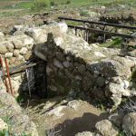
Qumran aqueduct near dam, tb051106061
Qumran aqueduct near dam, tb051106069
Qumran aqueduct near dam, tb051106073
Qumran aqueduct near dam, tb051106074
Qumran aqueduct near dam, tb051106075
Qumran aqueduct near dam, tb051106085
Qumran aqueduct, tb010812306
Qumran aqueduct, tb051106040
Qumran aqueduct, tb051106087
Qumran area aerial from west, tb010703341
Qumran caves and excavations aerial from south, bb00060074
Qumran caves and Wadi Qumran, tb052705309
Qumran caves from below, tb022806314
Qumran caves from Wadi Qumran, tb022806304
Qumran caves from Wadi Qumran, tb022806327
Qumran cemetery burials, tb052503348
Qumran cemetery middle finger from west, tb052503349
Qumran cemetery middle finger Tomb 1000 from east, tb052503353
Qumran cemetery middle finger Tomb 1000 from west, tb052503354
Qumran cemetery middle finger tomb, tb052503355
Qumran date factory, tb030401295
Qumran dining room, tb040900306
Qumran excavations aerial from west, bb00060079
Qumran excavations and caves aerial from east, bb00060073
Qumran excavations and cemetery from watchtower, tb030401296
Qumran excavations, tb011100307
Qumran excavations, tb040900308
Qumran from area of Caves 1 and 2, tb052606574
Qumran from southwest, tb092706263
Qumran from west with marl terraces and caves, tbs96329700
Qumran from west, dg021801298
Qumran from west, tb092706283
Qumran from west, tb092706284
Qumran from west, tb092706290
Qumran Iron Age water reservoir, tb040900310
Qumran latrine area view from settlement, tb030907224
Qumran mikveh stairs cracked by earthquake, tb011100311
Qumran mikveh stairs cracked by earthquake, tb011100312
Qumran mikveh, tb051106038
Qumran panorama, tb051106084
Qumran Roman period tower, tb062500315
Qumran scriptorium, dg030401300
Qumran scriptorium, tb011100316
Qumran scriptorium, tb040900317
Qumran scriptorium, tb052705323
Qumran stairs to scriptorium, tb052705324
Qumran study room with plastered installation, tb052705322
Qumran study room, tb052705313
Qumran study room, tb052705317
Qumran water channel, tb040900318
Qumran window for passing scrolls, tb052705316
Qumran windows for passing scrolls, tb052705320
Wadi Qumran and caves, tb052705310
Wadi Qumran and dam area, tb022806322
Wadi Qumran and Dead Sea, tb051106086
Wadi Qumran dam, tb051106058
Wadi Qumran dam, tb051106062
Wadi Qumran from above, tb051106054
Wadi Qumran with Khirbet Qumran and caves, tbs96319700
Wadi Qumran with Khirbet Qumran and Dead Sea, tb051106078
Wadi Qumran with rappellers, tb051106052
Wadi Qumran with ruins in left distance, tbs96319700
Wadi with flowers north of Qumran, tb030401313
Qumran Caves (51)
Qumran Cave 1 area, tb051106998
Qumran Cave 1 entrance from inside, tb011703342
Qumran Cave 1 entrance view to Dead Sea, tb011703345
Qumran Cave 1 from below, tb011703343
Qumran Cave 1 interior, tb011703344
Qumran Cave 1 wide, tb011703346
Qumran Cave 1 with people climbing, tb030401231
Qumran Cave 1, tb052308450
Qumran Cave 11, tb051106018
Qumran Cave 11, tb051106021
Qumran Cave 2 area, tb052308446
Qumran Cave 2 from below, tb052308457
Qumran Cave 2, tb052308452
Qumran Cave 3, tb011703347
Qumran Cave 3, tb051106025
Qumran Cave 3, tb051106036
Qumran Cave 4 from 4b, tb051106117
Qumran Cave 4 from below, cracks in ceiling, tb022806340
Qumran Cave 4 from below, tb022806307
Qumran Cave 4 from below, tb022806334
Qumran Cave 4 from Wadi Qumran, tb022806311
Qumran Cave 4 interior panorama, tb051106096
Qumran Cave 4 interior, tb051106092
Qumran Cave 4 interior, tb051106107
Qumran Cave 4 top entrance, tb051106091
Qumran Cave 4, tb030401294
Qumran Cave 4, tb030907226
Qumran Cave 4, tb062500305
Qumran Cave 4, tb102205327
Qumran Cave 4b from 4a, tb051106108
Qumran Cave 4b interior view to Wadi Qumran, tb051106116
Qumran Cave 4b interior, tb051106113
Qumran Cave 5 with ruins in background looking east, tbs96199802
Qumran Cave 5, tb051106088
Qumran Cave 6 and wadi, tb051106050
Qumran Cave 6, tb051106048
Qumran Caves 1 and 2 area, tb052308448
Qumran Caves 10 and 4b, tbs96209802
Qumran Caves 4 and 10, tb052705291
Qumran Caves 4 and 5, tb010810138
Qumran Caves 4, 6, 7, 8, 9, 10 with Wadi Qumran, tb052705290
Qumran Caves 4, 7, 8, 9, and 10 from below, tb022806305
Qumran Caves 7, 8, and 9, tb052705301
Qumran Caves 7, 8, and 9, tbs97049802
Qumran Caves 8 and 9 from below, tb022806321
Qumran Caves 8 and 9, tbs96299802
Qumran cliffs from Khirbet Qumran, tb030401302
Qumran cliffs with caves aerial, tb010703350
Qumran cliffs, tb011703351
Qumran cliffs, tb011703352
Qumran ruins and caves aerial, bb00060011
Shephelah (81)
Achzib, Khirbet Beida, decorated stone on summit, tb030407733
Achzib, Khirbet Beida, from north, tb021707872
Achzib, Khirbet Beida, from north, tb030407712
Achzib, Khirbet Beida, from southeast, tb021707865
Achzib, Khirbet Beida, ruins on summit, tb030407735
Beit Jimal from Beth Shemesh, tb062807441
Beit Jimal from south, tb030407660
Burma Road from below, tb072004646
Burma Road view to east, tbs96179801
Burma Road, tb072004665
Chalk Trough from Tell Beit Mirsim to north, tb102900214
Chalk Trough to Adullam view from Keilah, tb021900340
Chesalon Ridge from west, tb121601230
Diagonal Route aerial from south, tb010703249
Diagonal Route aerial from south, tb010703250
Green Line border road, tb102900244
Horvat Burgin near Achzib, Khirbet Beida, tb021707858
Horvat Burgin near Achzib, Khirbet Beida, tb021707862
Horvat Burgin summit, tb021707863
Horvat Burgin view southwest from Achzib, Khirbet Beida, tb030407730
Horvat Etri arcosolium, adr080728224
Horvat Etri building T from west, adr080728232
Horvat Etri burial cave reliefs, adr080728222
Horvat Etri mikveh in synagogue vestibule, adr080728260
Horvat Etri mikveh, adr080728214
Horvat Etri synagogue from southwest, adr080728234
Horvat Etri winepress, adr080728255
Jarmuth acropolis from lower city, tb030407689
Jarmuth acropolis with excavation trench, tb030407655
Jarmuth complex wall, tb030407686
Jarmuth Early Bronze gate, tb030407688
Jarmuth Early Bronze gate, tb030407692
Jarmuth Early Bronze gate, tb030407693
Jarmuth Early Bronze gate, tbs94099708
Jarmuth excavations from east, tb030407657
Jarmuth excavations with wildflowers, tb030407678
Jarmuth from Azekah, tb022201257
Jarmuth lower city excavations, tb030407683
Jarmuth lower city from acropolis, tb030407656
Judean hills and Chalk Trough from Tell Aitun, adr080716187
Judean hills near Guvrin Valley with rock quarry, tb030407746
Judean hills near Guvrin Valley with shepherd, tb030407744
Judean hills near Guvrin Valley, tb030407741
Keilah from west, tb021900258
Keilah from west, tb102900257
Khirbet Midras arcosolium, tbs45159009
Khirbet Midras columbarium, tb050504549
Khirbet Midras rolling stone tomb destroyed, tb050504552
Khirbet Midras rolling stone tomb interior, adr080714165
Khirbet Midras rolling stone tomb loculi, adr080714164
Khirbet Midras rolling stone tomb ossuary, adr080714166
Khirbet Midras rolling stone tomb ossuary, adr080714168
Khirbet Midras rolling stone tomb, tbs45179009
Khirbet Midras rolling stone, jj012411634
Kiriath Gat aerial from southeast, tb010703289
Makkedah, Khirbet el-Qom, from south, tb030407768
Makkedah, Khirbet el-Qom, from south, tb030407770
Nari crust in Shephelah, tb102900299
Nari crust in Shephelah, tb102900300
Neot Kedumim ancient village, tb102605442
Roman milestone along Diagonal Route in Shephelah, tb050701303
Roman milestone on Diagonal Route, tb050701304
Roman milestones along Diagonal Route in Shephelah, tb050701305
Shephelah Diagonal Route from south aerial, tb011606761
Shephelah valley with alluvial soil aerial, tbs132350112
Shephelah view northwest from Jarmuth panorama, tb030407658
Shephelah view southwest from Jarmuth panorama, tb030407652
Shephelah view west from southern Judean Hills panorama, tb030407755
Shephelah view west from southern Judean Hills, tb030407747
Shephelah view west from southern Judean Hills, tb030407749
Shephelah, Hill Country e of Lachish aerial, tb010703365
Shepherd with sheep at Makkedah, Khirbet el-Qom, tb030407764
Tell Aitun, possibly Eglon, and Adoraim Valley to west, tb102900329
Tell Aitun, possibly Eglon, Area B excavations, adr080716193
Tell Aitun, possibly Eglon, Area B plaster surface, adr080716195
Tell Aitun, possibly Eglon, from north, tb102900330
Tell Aitun, possibly Eglon, from south, tb102900331
Tell Beit Mirsim excavations to east, tb102900332
Tell Beit Mirsim excavations to east, tb102900333
Tell Beit Mirsim excavations, tb102900334
Tell Beit Mirsim from north, tb102900335
Shephelah-Aijalon Valley (33)
Aijalon Valley eastern end aerial from northwest, df010703203
Aijalon Valley eastern end aerial, df010703204
Aijalon Valley eastern end from south panorama, tb012503207
Aijalon Valley panorama, tb121601204
Aijalon Valley, Latrun, and Gezer from east, tb042600203
Aijalon, Tell Yalo, and Aijalon Valley from east, tb071406457
Aijalon, Tell Yalo, from east, tb012503369
Aijalon, Tell Yalo, from east, tb030407625
Aijalon, Tell Yalo, from south, tb030407621
Cave in hillside near Aijalon, Tell Yalo, tb012503228
Imwas, possible Emmaus, 1st century AD tomb interior loculi, tb100702226
Imwas, possible Emmaus, 1st century AD tomb, tb100702227
Imwas, possible Emmaus, Byzantine church aerial from west, tb010703296
Imwas, possible Emmaus, Byzantine church, tb100702228
Imwas, possible Emmaus, Byzantine church, tb100702229
Imwas, possible Emmaus, Roman tomb, tb100702230
Latrun aerial from north, tb010703294
Latrun aerial from southeast, tb010703295
Latrun Tegart Fort aerial, tbs134310112
Latrun Tegart Fort from east, tb121601270
Latrun Tegart Fort, tb071406491
Latrun Trappist Monastery aerial from northeast, tb010703297
Latrun Trappist monastery, tb062807423
Modiin aerial from southeast, tb010703322
Modiin Hasmonean tomb loculi, cd031107005
Modiin Hasmonean tomb loculi, cd031107006
Modiin Hasmonean tomb, cd031107001
Modiin Hasmonean tomb, cd031107013
Modiin Herodian synagogue area excavations, tb100702842
Modiin Herodian synagogue, tb100702501
Modiin tomb of the Maccabees, tb100702502
Sycamore fig tree near Aijalon, Tell Yalo, tb012503368
Tell Qoqa from west, tb101202270
Shephelah-Elah Valley (57)
Adullam aerial from south, tb122301201
Adullam area aerial from west, tb010703202
Adullam from north panorama, df051002201
Adullam from northeast, tb102900201
Azekah aerial from southeast, tb010703711
Azekah and Elah Valley aerial from e, tb010703712
Azekah and Elah Valley aerial from east, tb011606799
Azekah and Elah Valley aerial from south, tb010703261
Azekah and Gath from Jarmuth, tb030407662
Azekah and Gath from Jarmuth, tb121601222
Azekah from northeast, tb030407700
Azekah view to north, tb022201223
Cave of Adullam, tb021900210
Cave of Adullam, tb100800211
Chalk Trough and Judean hills view east from Adullam panorama, tb021707855
Chalk Trough and Judean hills view east from Adullam, tb021707852
Elah brook aerial, tbs133060112
Elah brook with students picking smooth stones, tbs75039303
Elah brook, tb010412786
Elah brook, tb092805456
Elah Valley aerial from west, df010703260
Elah Valley aerial from west, tb011606772
Elah Valley aerial from west, tb011606778
Elah Valley aerial from west, tb011606779
Elah Valley and Azekah view northwest from Socoh, tb021707830
Elah Valley from Azekah, tb011606733
Elah Valley from Khirbet Qeiyafa, tb010412784
Elah Valley from Socoh panorama, tb100800225 old
Elah Valley from Socoh panorama, tb100800225
Elah Valley pistachio tree, tbs75179303
Elah Valley view northwest from Socoh, tb100800327
Elah Valley view to north from Gath, tb060906129
Elah Valley view west from Socoh, tb021707817
Elah Valley with new wheat, tb010412779
Gath from Azekah, tb022201238
Khirbet Qeiyafa building, adr080731444
Khirbet Qeiyafa casemate wall near south gate, tb010412804
Khirbet Qeiyafa excavations near south gate, tb010412796
Khirbet Qeiyafa excavations near south gate, tb010412799
Khirbet Qeiyafa excavations near west gate, tb010412808
Khirbet Qeiyafa room with standing stone, tb010412809
Khirbet Qeiyafa south gate, tb010410796
Khirbet Qeiyafa south gate, tb010410830
Khirbet Qeiyafa south gate, tb010412791
Khirbet Qeiyafa south gate, tb010412794
Khirbet Qeiyafa wall near west gate, tb010410816
Khirbet Qeiyafa west gate, tb010410809
Khirbet Qeiyafa west gate, tb010410815
Khirbet Qeiyafa west gate, tb010410826
Khirbet Qeiyafa west gate, tb010412813
Khirbet Qeiyafa west gate, tb010412815
Sarigim, Li On, near Elah Valley aerial, tb011606770
Sheep grazing in Elah Valley, tb030407705
Socoh from northwest, tb010412787
Socoh from west, tb021707784
Socoh ruins with wildflowers, tb021707820
Socoh walls with wildflowers, tb021707824
Shephelah-Gezer (57)
Aijalon Valley view north from Gezer, tb070506178
Gezer aerial from northwest, tbs136170112
Gezer aerial from south, tbs136190112
Gezer aerial from west, tbs136350112
Gezer boundary inscription number 12 area, tb061307238
Gezer boundary inscription number 12, tb061307232
Gezer boundary inscription number 5 area, tb061307206
Gezer boundary inscription number 5, tb061307194
Gezer boundary inscription number 8 area, tb061307249
Gezer boundary inscription number 8, tb061307247
Gezer Calendar large replica, tb070506092
Gezer casemate wall excavations, tb062806957
Gezer casemate wall excavations, tb070506118
Gezer casemate wall excavations, tb070506121
Gezer casemate wall from east, tb070506136
Gezer excavations from east, tb010412765
Gezer excavations from west, tb010412758
Gezer excavations from west, tb010412761
Gezer from east, tb121601243
Gezer from east, tb121601244
Gezer from north, tb070506091
Gezer from south panorama, tb061307213
Gezer from southeast, tb061307265
Gezer Late Bronze tomb, tb062806038
Gezer Middle Bronze gate mudbricks, tb092602201
Gezer Middle Bronze gate with mudbricks, tb020901245
Gezer Middle Bronze gate, tb010412756
Gezer Middle Bronze gate, tb070506111
Gezer Middle Bronze tower and wall, tb040607296
Gezer Middle Bronze tower from north, tb020404660
Gezer Solomonic gate aerial from southeast, tbs136320112b
Gezer Solomonic gate area from south, tb042600237
Gezer Solomonic gate chamber with benches, tb052007792
Gezer Solomonic gate chamber with benches, tb052007796
Gezer Solomonic gate from east, tb070506165
Gezer Solomonic gate from north, tb040607304
Gezer Solomonic gate from northeast, tb040607306
Gezer Solomonic gate from northeast, tb070506150
Gezer Solomonic gate from northwest, tb062806992
Gezer Solomonic gate, tb010412767
Gezer Solomonic gate, tb010412768
Gezer Solomonic three-chambered gate, tbs44259009
Gezer standing stones aerial from west, tbs136340112
Gezer standing stones, df032002239
Gezer standing stones, tb010412769
Gezer standing stones, tb042600239
Gezer standing stones, tb052205986
Gezer standing stones, tb062806999
Gezer standing stones, tb070506201
Gezer standing stones, tb070506208
Gezer tell from south, tb042600241
Gezer tell with yellow flowers, tb040607313
Gezer watersystem, tb020404679
Gezer watersystem, tb040607315
Gezer watersystem, tb070506104
Gezer with view west to hill country, tb010412755
Wheatfield near Gezer, tb020707480
Shephelah-Guvrin Valley (53)
Bet Guvrin amphitheater aerial from east, tb010703716
Bet Guvrin amphitheater aerial from southeast, tb010703715
Bet Guvrin amphitheater aerial, tb011606754
Bet Guvrin amphitheater panorama, tb100902215
Bet Guvrin amphitheater, tb050701224
Bet Guvrin and Diagonal Route aerial from south, tb010703717
Bet Guvrin bell cave entrance, tb062300204
Bet Guvrin bell cave, tb062300205
Bet Guvrin bell caves aerial, tb011606758
Bet Guvrin bell caves aerial, tbs132100112
Bet Guvrin bell caves aerial, tbs132110112
Bet Guvrin bell caves, tb022807514
Bet Guvrin bell caves, tb062300206
Bet Guvrin bell caves, tb100902205
Bet Guvrin bell caves, tb100902216
Bet Guvrin cave with columbarium, tb022807532
Bet Guvrin cave with staircase, tb022807535
Bet Guvrin cave with staircase, tb022807545
Bet Guvrin cave with staircase, tb022807547
Bet Guvrin cave with view to sky, tb022807541
Bet Guvrin columbarium with pigeon, tb100902217
Bet Guvrin columbarium with pigeon, tb100902218
Bet Guvrin columbarium, tb100902219
Bet Guvrin Crusader church, tb050701225
Bet Guvrin Tomb of the Sidonian, tb022201226
Bet Guvrin Tomb of the Sidonian, tb022201227
Bet Guvrin Tomb of the Sidonian, tb022700207
Fields north of Tel Zayit, tb011606842
Guvrin Valley from east, tb102900245
Maresha area aerial from west, df010703300
Maresha cave excavation, tb011010407
Maresha cave inscription, tb011010401
Maresha excavations on northwest side, tb100902244
Maresha from east aerial, tbs131340112
Maresha from south, tb102900270
Maresha from west aerial, tb011606749
Moresheth Gath aerial from east, tb010703323
Moresheth Gath and Diagonal Route aerial from s, tb010703324
Moresheth Gath from Maresha, tb022201287
Moresheth Gath large columbarium, adr080729371
Olive press in Bet Guvrin cave, tb022807556
Olive press in Bet Guvrin cave, tb022807558
Reeds near Tel Burna, possible Libnah, tb011606888
Tel Burna from east, mm101006002
Tel Burna, possible Libnah, from northwest, tb011606862
Tel Zayit excavations on eastern slope with tags, tb011606835
Tel Zayit excavations on eastern slope with tags, tb011606838
Tel Zayit excavations on eastern slope with tags, tb011606841
Tel Zayit excavations on eastern slope, tb011606843
Tel Zayit from south, tb011606855
Tel Zayit from west, tb011606824
View west from Maresha, kg092800337
Wheatfield near Tel Burna, possible Libnah, tb011606859
Shephelah-Lachish (29)
Grapevines below Lachish, tb052001247
Lachish aerial from northwest, tb010703290
Lachish aerial from south, tb010703291
Lachish aerial from southeast, tb010703292
Lachish aerial from west, tbs131150112
Lachish approach ramp to city gate, tb022201260
Lachish approach ramp to gate, tb061100260
Lachish Assyrian siege ramp and gatehouse aerial from northwest, tb010703293
Lachish Assyrian siege ramp cross-section from west, tb022201266
Lachish city wall on west, tb022201261
Lachish from northeast, tb052306512
Lachish from northwest, tb022201262
Lachish from northwest, tb022201263
Lachish gatehouse aerial, tbs131170112
Lachish gatehouse where Lachish Letters found, tb061100261
Lachish inner gate and palace, tb061100263
Lachish inner gate from north, tb061100264
Lachish inner gate restoration, tbs79219402
Lachish Iron Age well and Nahal Lachish, tb052008338
Lachish northwestern slope with area of Fosse Temple, tb022201268
Lachish palace aerial, tbs131180112
Lachish palace foundation southeastern corner, tb022201265
Lachish palace from southeast, tb061100262
Lachish Persian palace pillar bases, tb100902241
Lachish trench showing wall change, tbs79239402
Lachish view to east, tb022201267
Lachish view to north, kg092800265
Nahal Lachish to west, tb102900298
Sheep grazing next to Lachish, tb052306508
Shephelah-Sorek Valley (43)
Beth Shemesh aerial from northwest, tbs134050112
Beth Shemesh aerial from south, tb010703720
Beth Shemesh aerial from south, tb011606785
Beth Shemesh aerial, tbs134190112
Beth Shemesh and Sorek Valley aerial from south, tb010703718
Beth Shemesh and Sorek Valley aerial from southeast, tb010703719
Beth Shemesh area aerial from northwest, tbs134070112
Beth Shemesh balk lines, tb051804665
Beth Shemesh Byzantine monastery, tb052405995
Beth Shemesh Byzantine monastery, tb062807443
Beth Shemesh excavated bedrock on western side, tb051804669
Beth Shemesh excavated squares, tb051804661
Beth Shemesh excavations on northern side, tb062807434
Beth Shemesh excavations on northern side, tb062807440
Beth Shemesh from west, tb051804674
Beth Shemesh Iron Age reservoir entrance, tb011606707
Beth Shemesh Iron Age reservoir entrance, tb011606720
Beth Shemesh Iron Age reservoir, tb052207805
Beth Shemesh Iron Age reservoir, tb052207808
Beth Shemesh Iron Age tomb entrance, tb051804683
Beth Shemesh large rocks on southern side, tb011606685
Beth Shemesh Middle Bronze gate, tb011606700
Beth Shemesh Middle Bronze gate, tb022807454
Beth Shemesh Middle Bronze wall, tb092805427
Beth Shemesh mudbricks near Middle Bronze gate, tb092805441
Beth Shemesh rock on western side, tb051804675
Eshtaol from east, tb121601237
Eshtaol from southwest, tb010412776
Sorek Valley and Zorah aerial from south, tb010703366
Sorek Valley from Beth Shemesh panorama, eh01041230p
Sorek Valley from Beth Shemesh view northeast, tb052405994
Sorek Valley from Beth Shemesh view west, tb021804909
Sorek Valley from Beth Shemesh view west, tb052405993
Sorek Valley from north panorama, tb121601307
Steps carved in bedrock near Eshtaol, tb062807431
Timnah from south, tb030407642
Timnah from south, tb100702275
Timnah from southwest, tb030407632
Zorah aerial from southeast, tb010703385
Zorah and Eshtaol from Beth Shemesh, tb062300343
Zorah and Eshtaol from south, tb030407661
Zorah from south, tb010412775
Zorah tomb of Samson and Manoah, tb060204771
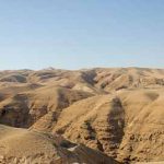
Wilderness of Judah-North (92)
Arab village and fields near Herodium, tb021107495
Ascent of Adummim and Wadi Qilt aerial from east, tb010703282
Ascent of Adummim near Jericho, tb113006541
Ascent of Adummim near Jericho, tb113006582
Ascent of Adummim ridge, tb113006677
Ascent of Adummim Roman road remains, tb113006723
Ascent of Adummim Roman road remains, tb113006725
Ascent of Adummim Roman road remains, tb113006728
Ascent of Adummim Roman road remains, tb113006731
Ascent of Adummim Roman road remains, tb113006736
Ascent of Adummim Roman road remains, tb113006741
Ascent of Adummim with men on donkeys, tb113006534
Bedouin camp near Jericho, tb022207363
Bedouin camps in Judean wilderness, tb113006668
Bedouin camps near Jericho, tb022207367
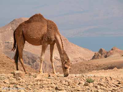
Camel in Judean wilderness, tb021107549
Camel in Judean wilderness, tb111603107
Camels in Judean wilderness, tb100200208
Camels in Judean wilderness, tb111603140
Cave near Mar Saba monastery, tb010107349
Chariton cave interior, tb111706096
Goats along Ascent of Adummim, tb092602705
Goats and shepherd along Ascent of Adummim, tb092602701
Goats grazing Judean wilderness on rocky hill, tb021107521
Good Samaritan Inn below Khan el-Hatruri, tb011703280
Good Samaritan Inn, tb100200242
Good Samaritan Inn, tb113006626
Good Samaritan Inn, tb113006638
Hyrcania from east, mm090314006
Hyrcania from east, tb100200249
Hyrcania ruins looking south, tb100200251
Hyrcania view east from room on top, tb100200250
Hyrcania view north, tb100200252
Judean wilderness aerial, df010703284
Judean wilderness and Dead Sea, tb092706221
Judean wilderness at sunset, tb021107716
Judean wilderness from Tekoa, tbs43169009
Judean wilderness hillside, tb113006631
Judean wilderness in spring along Taiyibeh road near Jericho, tb022207361
Judean wilderness in spring near Jericho, tb022207359
Judean wilderness in spring with Bedouin camps near Jericho, tb022207366
Judean wilderness in spring with plowed field, tb022007974
Judean wilderness in spring, tb022007960
Judean wilderness in spring, tb022007973
Judean wilderness near Jericho, tb113006551
Judean wilderness near Jericho, tb113006559
Judean wilderness tree planted in stream, tb113006580
Judean wilderness west of Jericho aerial, tb010703285
Judean wilderness west of Jericho aerial, tb010703286
Judean wilderness west of Jericho, tb092706254
Judean wilderness with flowers, df022702232
Judean wilderness with oasis and sheep, tb113006604
Judean wilderness with sheep grazing on Christmas, tbs79039312
Judean wilderness with sheep, tb113006603
Judean wilderness, tb113006600
Judean wilderness, tb113006605
Khan el-Hatruri excavations, tb113006639
Khan el-Hatruri with view to Jerusalem, tb113006623
Maale Adummim aerial, tb010703299
Man with donkeys on Ascent of Adummim, tb113006572
Mar Saba monastery from above, tb010107323
Mar Saba monastery from east, tb010107346
Mar Saba monastery interior with view to wilderness, tb010107308
Mar Saba monastery interior, tb010107301
Mar Saba monastery wilderness caves, tb010107320
Mar Saba monastery wilderness caves, tb010107321
Mar Saba monastery with Nahal Kidron, tb010107318
Mar Saba monastery, tbs79049312
Mar Saba tomb of Saint Saba, tb100200324
Martyrius monastery courtyard, tb071204318
Martyrius monastery eastern entrance, tb071204304
Martyrius monastery in Maale Adummim aerial, tb010703302
Martyrius monastery main church mosaic, tb071204335
Martyrius monastery southeastern corner, tb071204329
Mount of Olives from east, tb113006745
Nahal Kidron near Mar Saba monastery, tb010107328
Nahal Kidron near Mar Saba, tb100200296
Nebi Musa cemetery, tb051106129
Nebi Musa courtyard, tb051106126
Nebi Musa from north, tb051106119
Nebi Musa from north, tb051106122
Nebi Musa interior, tb051106130
Nebi Musa minaret, tb051106131
Sea level sign on road to Jericho, tb051708045
Sea level sign with camel, tb020506932
Sheep grazing in Judean wilderness with grass, tb021107701
Sheep grazing in Judean wilderness with grass, tb021107704
Sheep in Judean wilderness with modern highway, tb113006682
St Theodosius Monastery near Bethlehem, tb010107298
Sunset over Mount of Olives, tb021107719
Valley of Zeboim route aerial from east, tb010703370
Wadi in Judean wilderness along Ascent of Adummim, tb113006739
Wilderness of Judah-South (69)
Acacia tree in Nahal Tseelim, tb031504918
Acacia tree near Dead Sea, tb120703102
Camel above En Gedi with Dead Sea, tb021603226
Camel above En Gedi, tb021603227
Chariton monastery from south, tb111706076
Flowers in Nahal Tseelim, tb031504973
Judean wilderness and Lisan, tbs95289712
Judean wilderness and Nahal Arugot aerial from southeast, tb010703381
Judean wilderness and Nahal Darga, Wadi Murabbaat, near Dead Sea aerial from south, tb010703383
Judean wilderness panorama, tb021107558
Judean wilderness with acacia tree in wadi, tb021107524
Judean wilderness with grass, tb021107531
Judean wilderness with grass, tb021107535
Judean wilderness with grass, tb021107562
Judean wilderness with green growth in ravine, tb021107527
Judean wilderness, tb021107558
Judean wilderness, tb092105304
Judean wilderness, tb111603118
Nahal Arugot from east, tb021107514
Nahal Arugot panorama, tb021107516
Nahal Bokek with flowing water, tb030106457
Nahal Bokek with flowing water, tb030106459
Nahal Bokek with flowing water, tb030106461
Nahal Bokek with vegetation, tb030106453
Nahal Bokek with vegetation, tb030106465
Nahal Darga, Wadi Murabbaat, aerial from north, tb010703332
Nahal Darga, Wadi Murabbaat, aerial from west, tb010703333
Nahal Darga, Wadi Murabbaat, aerial, tb010703334
Nahal Darga, Wadi Murabbaat, aerial, tb010703335
Nahal Darga, Wadi Murabbaat, Bar Kochba cave view from interior, tb021107619
Nahal Darga, Wadi Murabbaat, Bar Kochba cave view from interior, tb021107627
Nahal Darga, Wadi Murabbaat, Bar Kochba cave, tb021107616
Nahal Darga, Wadi Murabbaat, Bar Kochba cave, tb021107630
Nahal Darga, Wadi Murabbaat, Bar Kochba caves, tb021107598
Nahal Darga, Wadi Murabbaat, Bar Kochba caves, tb021107615
Nahal Darga, Wadi Murabbaat, from west, tb021107570
Nahal Darga, Wadi Murabbaat, from west, tb021107637
Nahal Darga, Wadi Murabbaat, tb021107575
Nahal Darga, Wadi Murabbaat, tb021107580
Nahal Darga, Wadi Murabbaat, tb021107583
Nahal Darga, Wadi Murabbaat, tb021107588
Nahal Darga, Wadi Murabbaat, tb021107605
Nahal Darga, Wadi Murabbaat, tb021107614
Nahal Darga, Wadi Murabbaat, with Bar Kochba caves, tb021107607
Nahal Darga, Wadi Murabbaat, with Bar Kochba caves, tb021107610
Nahal Mishmar Cave of Treasure, tb120703023
Nahal Mishmar outlet and Dead Sea, tb120703097
Nahal Mishmar with Cave of Treasure, tb120703021
Nahal Mishmar with Cave of Treasure, tb120703030
Nahal Mishmar with hikers, tb120703070
Nahal Tekoa from north, tb111706091
Nahal Tekoa from northwest, tb111706069
Nahal Tseelim aerial, tb010703382
Nahal Tseelim canyon, tb031504000
Nahal Tseelim canyon, tb031504003
Nahal Tseelim column formations, tb031504924
Nahal Tseelim from east, tb031504005
Nahal Tseelim from northeast, tb120703012
Nahal Tseelim from southeast, tb031504994
Nahal Tseelim outlet from east, tb031404877
Nahal Tseelim outlet from east, tb120703010
Nahal Tseelim pools of water, tb031504931
Nahal Tseelim tributary, tb031504965
Nahal Tseelim with Dead Sea, tb031504963
Rappelling in Nahal Darga, Wadi Murabbaat, tb021107566
Rappelling in Nahal Darga, Wadi Murabbaat, tb021107567
Rappelling in Nahal Darga, Wadi Murabbaat, tb021107571
Sheep finding shade in Nahal Tekoa, tb111706085
Wilderness and Dead Sea aerial east of Arad, tb010703379
Wilderness of Judah-Wadi Qilt (52)
Aqueduct near Ein Qilt, tb021107694
Ein Perat manmade pool, tb020804300
Ein Perat monk’s cave cross, tb020503253
Ein Perat monk’s cave from below with monk, tb020503254
Ein Perat monk’s cave interior, tb020503255
Ein Perat pool, tb020503256
Ein Perat running water, tb020503257
Ein Perat view downstream, tb020804274
Ein Perat with still waters, tb020503251
Ein Perat with tree and running water, tb020503259
Ein Perat with tree, tb020804290
Ein Perat, tb020804266
Ein Perat, tb020804282
Ein Qilt and Judean wilderness from south, tb021107696
Ein Qilt from south, tb021107695
Ein Qilt from south, tb021107699
Nahal Perat aqueduct, tb020804341
Nahal Perat steep cliffs, tb020804224
Nahal Perat stream, tb020804351
Nahal Perat with green slopes, tb020804332
Nahal Perat with reeds, tb020804378
Nahal Perat, tb020804379
Sheepfold near Ein Perat, tb020503229
St Chariton’s Monastery near Ein Perat, tb020503401
Wadi Qilt aerial from west, tb121704170
Wadi Qilt aerial, bb00050034
Wadi Qilt and Jordan Rift aerial from south, tb010703378
Wadi Qilt and Judean Wilderness view north, tb091504749
Wadi Qilt and Judean wilderness with Cypros, tb051708048
Wadi Qilt and Judean wilderness with Cypros, tb051708049
Wadi Qilt and St George’s Monastery from below, tbs46109010
Wadi Qilt below St George’s Monastery, tb091504729
Wadi Qilt canyon walls, tbs46039010
Wadi Qilt caves near Ein Fawwar, tb031405115
Wadi Qilt caves near Ein Fawwar, tb031405160
Wadi Qilt Ein Fawwar with water, tbs74139302
Wadi Qilt flash flood in Jericho, fj040206101
Wadi Qilt flash flood waterfall, fj040206102
Wadi Qilt flash flood with waterfall, fj040206103
Wadi Qilt from south, tb092706258
Wadi Qilt near Ein Fawwar cliffs, tb020503372
Wadi Qilt near Ein Perat, tb020503375
Wadi Qilt St George’s Monastery aerial from south, tb010703376
Wadi Qilt St George’s Monastery aerial from south, tb010703377
Wadi Qilt St George’s Monastery closeup, tb091504761
Wadi Qilt St George’s Monastery from east, tb051604654
Wadi Qilt St George’s Monastery, tb052006460
Wadi Qilt St George’s Monastery, tb052205969
Wadi Qilt with arched aqueduct, tb091504754
Wadi Qilt with arched aqueduct, tb091504755
Wadi Qilt with Roman and modern aqueducts, tbsk97269709
Wadi Qilt with running water near Ein Fawwar, tb020503373